Innovative teaching and learning methods and virtualization of the study process are applied. Lectures, seminars, discussions, group work, practical tasks, literature analysis, project preparation, etc. Student-oriented independent work, based on tasks, group work, in which problematic and critical thinking are very important, project work.
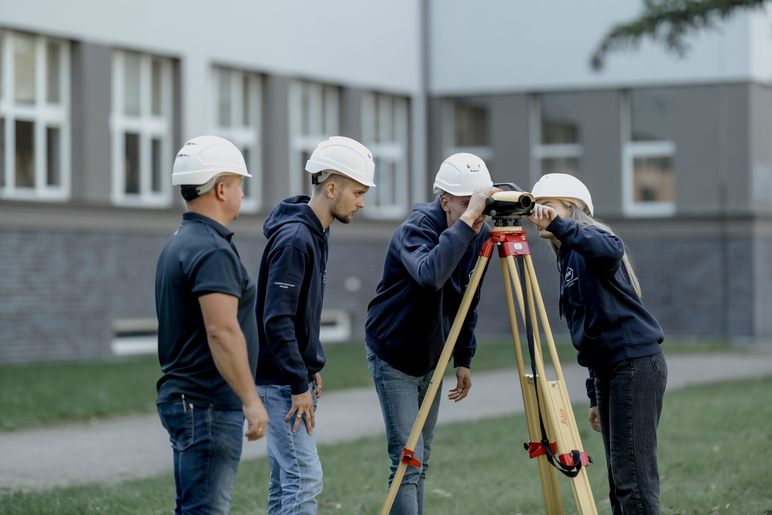
Measurements are carried out using modern geodetic instruments, GPNS equipment using stationary 3D scanners and unmanned aerial vehicles (drones). 3D surface models are developed using 3D technology with collected data from LIDAR and with other methods measured areas. Cadastral measurements of buildings and land plots are being carried out, topographic and engineering digital geodetic plans are being prepared.
Career
Possibilities to make a career in institutions for digital geodesy measuring, companies for real estate cadastre data processing and evaluation, construction organizations, municipalities or other institutions for spatial data processing, storage and geomatics (GIS) departments and centers, to create private companies.
The aim of Professional Bachelor study of Digital Geodesy programme is to prepare highly qualified geodesy specialist. They will be able to use of modern geodetic devices, GPNS equipment, stationary 3D scanners and drones with equipment of remote sensing technology. Specialists will be able to use 3D geoinformation (GIS) technology to create 3D surface models with LIDAR; they will be able to use other methods of measured area data, performing cadastral measurements of structures and land plots, preparing topographic and geodetic plans for underground engineering networks.
╳
Subjects
Study subjects (127 credits): Professional Communication, Foreign Language (English, Russian), Applied Research Methodology, Basics of Management, Engineering Graphics, Geoinformatic, Computer-Aided Design Systems, Basics of Geodesy, Remote Sensing Technologies, Spatial Planning, Geodetic Instruments and Automation of Measurements, Cadastral Measurements, Cartography, Processing of Metrological and Geodetic Measurements, Digital maps, Photogrammetry, Business Economics.
╳
Study results
Graduate:
1. Adapt traditional and innovative measurements engineering techniques and use methods for design & development, combinating cost, benefit, safety of humans, quality and reliability.
2. Apply knowledge of new technologies and solve geodetic, cartographic, spatial information infrastructure and territorial planning challenges.
3. Use methods of mathematical statistical data processing, measurement reliability and uncertainty determination methods, as well as be able to collect, analyze and systematize data.
4. Use measurement information for engineering research and other applied research, design different types of engineering maps and create information data sets.
5. Conduct practical research, planning and designing experiments, starting with problem formulation, selection of research equipment, and evaluation and qualification of results.
6. Make measurements with modern measuring devices, to analyze the results of real estate administration, formation, evaluation methods, that meet Lithuanian and EU standards and regulations.
7. Apply measurements software to solve engineering problems, obtain and process data solutions, produce computer graphics and perform digital projects.
8. Work independently as well as in a team, with a holistic understanding of the impact of engineering decisions on society and the environment, and in compliance with professional ethics and engineering standards.
9. Find out the interfaces of measurement solutions with their economic consequences, to understand the importance of individual lifelong learning and to prepare for it, to be able to communicate with the engineering community and the general public.
╳
Admissions
40%
Mathematics
20%
Physics
20%
Lithuanian language and literature
20%
Weighting factor for any subject that does not overlap with the first and second
Cookies and Privacy
To provide the best experiences, we use technologies like cookies to store and/or access device information. Consenting to these technologies will allow us to process data such as browsing behavior or unique IDs on this site. Not consenting or withdrawing consent, may adversely affect certain features and functions.
Functional
Always active
The technical storage or access is strictly necessary for the legitimate purpose of enabling the use of a specific service explicitly requested by the subscriber or user, or for the sole purpose of carrying out the transmission of a communication over an electronic communications network.
Parinktys
Techninė saugykla arba prieiga yra būtina teisėtam tikslui išsaugoti nuostatas, kurių neprašo abonentas ar vartotojas.
Statistics
Techninė saugykla arba prieiga, kuri naudojama tik statistiniais tikslais.Techninė saugykla arba prieiga, kuri naudojama tik anoniminiais statistikos tikslais. Be teismo šaukimo, jūsų interneto paslaugų teikėjo savanoriško įsipareigojimo ar papildomų įrašų iš trečiosios šalies, vien šiuo tikslu saugoma ar gauta informacija paprastai negali būti naudojama jūsų tapatybei nustatyti.
Rinkodara
Techninė saugykla arba prieiga reikalinga norint sukurti naudotojo profilius reklamai siųsti arba sekti vartotoją svetainėje ar keliose svetainėse panašiais rinkodaros tikslais.